The River That Was Not Meant to Be a River
On the evolution of the American mindset toward water, told through the life and disappearance of a single river in the Sonoran Desert.
Every society has a theory of what a river is. The theory is usually tacit, embedded in law, in engineering, in the way children are taught to point at maps. We inherit it without quite noticing, and we mistake it for the thing itself. A river, we say, and we mean something specific by the word - something that sits underneath the sentence without ever being spoken aloud. In the English-speaking Americas, the theory of a river changed several times in the nineteenth and twentieth centuries, and each change left evidence in the landscape. The Salt River in central Arizona is one of the places where that evidence is most legible, because the Salt River happens, today, to not be a river at all.
Where it passes through the city of Phoenix, the Salt is a dry channel. Its water has been taken out four miles upstream, at the Granite Reef Diversion Dam, and routed through the Arizona and South Canals to farms and to the treatment plants that serve metropolitan Phoenix’s nearly five million residents. On most days the U.S. Geological Survey gage at 51st Avenue records no flow at all. The riverbed is sand, gravel, invasive vegetation, and, in many places, the mined pits and industrial fill that have accumulated there since the 1930s. This is the Salt River in 2026: a dry bed running beside a freeway, visible from Sky Harbor Airport as a brown seam, crossed by highways that do not acknowledge it.
How does a river become not a river? This is not, in the first instance, a question about engineering. Dams have been built on many rivers that remain rivers. The Salt became what it is today because of a sequence of decisions legal, administrative, commercial, ideological that expressed a particular mindset. That mindset did not arrive in Arizona fully formed. It evolved, and the Salt River’s transformation tracks the evolution closely. Reading the river is a way of reading what Americans, over a hundred and sixty years, have believed a river to be.
This essay traces that evolution through five moments in the Salt’s history, each corresponding to a distinct theory of what the river was. The moments are not discrete. They overlap, and each leaves residue in the present. But taken together, they describe an intellectual arc that the landscape still carries.
One The River as Obstacle
The inherited frame: water as shared commons
When the United States inherited the western territories in the middle of the nineteenth century, it inherited them with a legal theory of water already in hand. The theory was English common law, carried across the Atlantic by colonists and elaborated through two hundred years of American jurisprudence. In that theory, water belonged to the river, and the river belonged, in a sense, to itself. Landowners whose property touched a stream held riparian rights the right to use the water adjacent to their land, provided that their use did not diminish the water’s availability downstream. Water was understood as continuous, shared, and inseparable from its course. You could use the river; you could not take the river.
This theory worked in the eastern United States, where rainfall was abundant and rivers ran year-round. It did not work in the arid West. By the 1840s, American settlement had begun to push beyond the hundredth meridian, into a landscape where water was not continuous, not abundant, and could not be shared in the riparian sense without some claims collapsing into others. The collision between the inherited legal frame and the new hydrological reality was acute, and it was settled permanently, it turned out during a specific historical moment in California.
The California Gold Rush, beginning in 1849, brought miners into the Sierra Nevada foothills who needed water to wash gold-bearing gravel from stream beds. The miners were not landowners in the riparian sense. They were claimants on the public domain, and the gold they sought was usually not at the river but in gulches and ravines miles away. To get water to the gold, the miners dug ditches. Some of the ditches were long. Some were extraordinarily long engineering feats constructed by men with no formal training, working in canyons the U.S. government had not yet surveyed. And under riparian law, none of those ditches had any legal standing at all.
So the miners invented a different law. They drafted camp codes that recognized, among themselves, a simple principle: whoever had first put water to productive use held the right to continue that use. The principle was summarized, eventually, in a phrase that now dominates western water law: first in time, first in right. The courts accepted it. The 1855 California Supreme Court case Irwin v. Phillips recognized the priority of first diversion over later diversion. The doctrine spread. By the time Colorado drafted its state constitution in 1876, prior appropriation had replaced riparian rights entirely in much of the West. The 1866 federal Mining Act, passed by Congress in the middle of the Civil War’s aftermath, extended the principle to the public lands: the mineral lands of the public domain, both surveyed and unsurveyed, are hereby declared to be free and open to exploration and occupation by all citizens of the United States.
The new doctrine did something specific, and worth naming clearly. It dissolved the older theory in which water belonged to the river and replaced it with a theory in which water belonged to whoever first put it to use. Water, in the new frame, was no longer a condition of the landscape. It was a resource a thing that could be claimed, measured, divided, transferred, and lost. The river, under this theory, was no longer a continuous body. It was a quantity. What had been a single thing became, in effect, many smaller things, distributed among claimants according to the order of their arrival.
This was the first mindset the American West carried into Arizona Territory. When the first settler canal in the Salt River Valley was dug in 1867 The first canal built by these new arrivals was the Salt River Valley Canal, completed in 1868 it was dug under the doctrine of prior appropriation. The canal’s builders did not ask whether the Salt River could spare the water. They asked whether anyone else had put that water to use first. When the answer came back in the forms they recognized as legitimate that is, in the forms produced by other settlers the answer was no. The fact that the Akimel O’odham, downstream on the Gila, had irrigated the desert for a thousand years was, within the new legal frame, not a relevant consideration. Their use was not a claim. Their claim had never been filed.
This is worth sitting with. The doctrine of prior appropriation is sometimes described as a pragmatic response to the aridity of the West a rule that evolved because the older rule could not work. That description is not wrong, but it is incomplete. The doctrine did not merely replace one rule with another. It embedded, in the law of the land, a specific theory of what water was. That theory made certain claims visible and certain claims invisible. It made the miner’s ditch visible. It made the O’odham canal, dug a millennium earlier, invisible. Aridity did not require that outcome. The outcome was a choice, expressed as a doctrine, written into the legal architecture of every western state. We are still living inside that choice.
Two The River as Territory
1864: The military frame
In April 1864, the Arizona Miner newspaper the official paper of Arizona Territory, published in Prescott announced an expedition. One hundred men, commanded by Lieutenant Colonel King S. Woolsey, drawn from the main mining and ranching districts of the Territory. Their stated objective: a specific named Apache village, located, the paper said, on the Salt River.
Five months after the announcement, the same paper ran Woolsey’s after-action report to Governor John N. Goodwin on its front page. Dated August 28, 1864, from Prescott, the dispatch reported the expedition’s arrival at the river. The second sentence, in Woolsey’s handwriting:
We followed Pinal creek down to its mouth, and then proceeded down Salt river to camp which we reached about sun down.Col. King S. Woolsey to Governor Goodwin · Weekly Journal-Miner, September 21, 1864, p. 1
This is the second mindset. Under the first, water was a resource to be claimed through productive use. Under the second, the land through which water flowed was territory to be secured through military action. The two mindsets were not in tension. They were complementary. Prior appropriation required that there be a state willing to enforce the doctrine against competing claimants, and in Arizona Territory in the 1860s, the competing claimants were the Apache, the Yavapai, and the Akimel O’odham nations who had lived along these waters for centuries and who did not recognize the doctrine. The military expeditions of the 1860s and 1870s and they were many cleared the ground on which the legal doctrine could operate.
The word clearing is doing specific work here. I want to be honest about what I mean by it. The territorial paper of the 1860s did not speak about Indigenous presence along the rivers as a cultural or political fact to be accommodated. It spoke about Indigenous presence as an obstacle to settlement. Editorials from the period use words like extirpation openly. I will not reproduce that rhetoric here, but I want the reader to understand that the gentleness of the phrase proceeded down Salt river is deceptive. The expedition reached the Salt at sundown because earlier in the day, and on many days before and after, it was doing the violent work that made the subsequent legal and commercial transactions possible.
What the military frame did, culturally, was to produce a second vocabulary for rivers. Rivers were no longer only resources to be apportioned among claimants. They were axes of territorial control lines along which populations could be organized, reservations could be drawn, and the movements of unincorporated peoples could be restricted. The Salt River, under this frame, became something the U.S. government had to take in order for the doctrine of prior appropriation to mean anything at all. The Woolsey expedition was an early moment in that taking. It would continue, in Arizona, for the next decade and a half. The last major military operation against Apache populations in the territory did not conclude until 1886.
It is striking, in retrospect, how smoothly the military frame handed off to the commercial one. Within a generation of Woolsey’s dispatch, the land the expedition had reached was being surveyed, titled, canal-ed, irrigated, and traded as real estate. The violence of the 1860s and 1870s became, in the 1880s and 1890s, the precondition for agricultural boosterism. The settlers who bought into the Salt River Valley after 1880 did not need to think about Woolsey. Woolsey’s work was already done.
Three The River as Real Estate
The doctrine applied: valley into property
The settler mindset in the Salt River Valley in the late nineteenth century is best understood as the doctrine of prior appropriation translated into land. Once water could be claimed as a separate thing from the land through which it flowed, and once the land itself had been cleared of Indigenous presence, the valley became legible as real estate in a way it had not been before. Every piece of the conversion was reported in the territorial paper, sometimes on the front page, often as advertisements in the back.
Consider the infrastructure of the conversion. In September 1866, the Journal-Miner reported that the Union Pacific railroad was progressing west at twenty miles per week. The transcontinental line, completed in 1869, would eventually connect the Arizona markets to national commodity and capital flows. In November 1867, the paper reprinted the full text of the 1866 Mining Act on its front page the federal statute that formalized prior appropriation on the public lands. In October 1867, thirty-six residents of Wickenburg petitioned the Territorial Legislature to carve a new county out of Yavapai. The county they asked for was named Maricopa, after the Pee-Posh people whose lands would be encompassed within it, though the Pee-Posh themselves were not party to the petition.
Each of these is a piece of the architecture. The railroad made commodity transport possible. The Mining Act made claims transferable. The county created the administrative container within which titles could be recorded. The canals, constructed beginning in 1867, made the water physically reachable. Put them together and you have the basic infrastructure for converting the Salt River Valley into private property owned by settlers, financed by eastern capital, taxed by a territorial government whose boundaries had been drawn in consultation with no one who had lived there before 1860.
Then, in 1868, the word Phoenix appears in the territorial paper for what may be the first time. It appears in a column headed “Bad Policy,” in which a military officer describes soldiers from the Akimel O’odham and Pee-Posh nations who were, at the time, serving in the U.S. military’s campaigns against the Apache as untrustworthy because they had, the officer alleges, taken corn from settler fields.
Recently, at Phoenix, on Salt river, they entered the cornfields of the settlers, ate what melons, etc., they wanted, took what they could pack off, and maliciously trampled down acres of the precious grain.Weekly Journal-Miner · October 3, 1868, p. 2
The sentence is worth reading twice. The cornfields are described as belonging to the settlers. They are being entered by people whose ancestors had farmed this land for approximately fifteen hundred years. In 1868, the settler cornfields are, at most, four years old. The language reverses what any honest accounting of the chronology would show. And it does so not as an individual error but as a systemic feature of the frame: the doctrine of prior appropriation makes the older farming invisible, because that farming was never filed, never claimed, never diverted under the legal forms the doctrine recognizes.
This is the point in the arc at which the American mindset toward rivers crystallizes into something peculiar and durable. The river, under this mindset, is a quantity of water to be extracted. The valley is a grid of parcels to be sold. The people who built the first canals are no longer legally present. And the future is understood to belong to whichever settlers arrived with the right paperwork.
The doctrine of prior appropriation does not merely allocate water. It tells a story about who counts as a first user. The story is wrong, and it is binding.
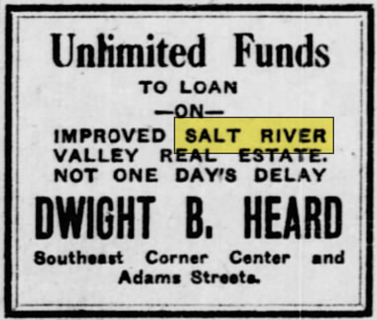
The commercial phase of the Salt’s history ran from roughly 1870 through the turn of the twentieth century. During this period, settler farmers established cotton, alfalfa, citrus, and grain operations in the valley. Private canal companies proliferated. Land prices rose. The Bartlett-Heard Ranch, built up by Dwight B. Heard after 1901 on 6,070 acres centered at what is now 24th Street and Broadway Road, became one of the most successful diversified farming operations in the territory. Heard would go on to publish the Arizona Republican newspaper and to shape, through his real estate advertisements and his editorials, the public image of the Salt River Valley as a land of opportunity. His advertisements which offered financing, crop rotation advice, and evocative photographs of orchards in bloom are among the purest examples of the real-estate mindset applied to a formerly Indigenous-governed landscape.
But the doctrine of prior appropriation, the settler canals, and the real estate market together had a problem. They could not, by themselves, produce water on demand. The Salt River’s flow was seasonal and often catastrophic floods alternated with droughts in patterns that no private canal company could manage. The flood of 1891 washed out most of the private diversions. By 1900, the valley was facing a water crisis. The commercial mindset had reached its structural limit. What came next is the fourth mindset, and the one that built the Salt River we now see.
Four The River as Engineering Problem
Reclamation: water as a federal project
The National Reclamation Act of 1902, signed into law by President Theodore Roosevelt, marks the moment at which the American mindset toward rivers shifted again. Prior appropriation and territorial clearance had produced a western landscape of small-scale irrigation, private canal companies, and speculative land development. What the Reclamation Act did was add a new actor to the system the federal government as engineering agent and a new theory of what a river was. Under the reclamation frame, a river was not primarily a resource to be claimed or a territory to be secured. It was an engineering problem to be solved.
The Salt River Project, authorized on March 14, 1903, was one of the first five projects initiated under the Reclamation Act. Its centerpiece was Theodore Roosevelt Dam, constructed on the Salt River at the confluence with Tonto Creek, eighty miles upstream of Phoenix. Construction began in 1903 and concluded in 1911. The dam stood 280 feet high and created what was, at the time, the largest reservoir in the world. Downstream, a diversion structure called the Granite Reef Diversion Dam was built between 1906 and 1908 to redirect water from the Salt and Verde Rivers into the Arizona and South Canals. Below Granite Reef, the Salt River’s channel would never again be, on most days, a river.
The Salt River Project is usually celebrated as a triumph of engineering, and by most of its own design criteria, it is. It provided reliable water to what became one of the fastest-growing metropolitan areas in the United States. It enabled the agricultural development of 240,000 acres. It generated hydroelectric power. It continues, in 2026, to serve nearly three million people with remarkable reliability. By any narrow accounting, it worked.
What the engineering frame did culturally is more complicated to assess. It shifted the locus of decision-making about rivers from private claimants and local canal companies to federal engineers and agricultural improvement districts. It produced a particular aesthetic of the river-as-system: the river as a set of flows to be measured, a set of reservoirs to be filled, a set of deliveries to be scheduled. Under the engineering frame, a river was a kind of machine. Its function was to deliver water reliably from the watershed to the end user, and everything that did not contribute to that function was, in the clarifying language of engineering, loss.
Two kinds of loss are worth naming. The first is hydrological. The lower Salt, below Granite Reef, was no longer wet. Riparian forests of cottonwood and willow died off through the 1910s and 1920s. The bird populations that had depended on them declined. The river’s floodplain, no longer regularly inundated, lost the sediment deposition patterns that had sustained its ecology. From the engineering frame, this loss was not a failure of the project. It was an acceptable cost of the reliability the project delivered.
The second loss was jurisdictional. The water rights adjudicated under the 1910 Kent Decree the foundational document that still governs Salt River water allocation treated the Akimel O’odham and Pee-Posh communities whose reservations sat adjacent to the Salt and on the Gila as minor claimants whose rights could be partially recognized only insofar as they did not interfere with the federal project. The Gila River Indian Community’s water rights were not comprehensively settled until 2004 almost a century after the Kent Decree. The Salt River Pima-Maricopa Indian Community’s rights were not settled until 1988. The Fort McDowell Yavapai Nation’s rights were not settled until 1990. During the intervening decades, the communities most historically dependent on the Salt and Gila Rivers lived through what the Gila River Indian Community itself calls the forty years of famine a period, from approximately 1880 to 1920, during which upstream diversions and federal engineering deprived the community of the water that had sustained its agriculture for millennia. The dietary and public-health consequences of that period continue, in the form of a type-two diabetes epidemic, into the present.
I note these losses not to indict the Reclamation Service, whose engineers were, by their own lights, solving the problem they had been assigned to solve. I note them because the engineering frame is still the dominant frame in which the Salt River is understood. When city planners, water managers, and federal agencies discuss the river today, they do so in the vocabulary of flows, allocations, storage, and delivery. That vocabulary is useful, and it is accurate within its own terms. But it is not the only vocabulary available, and it is not adequate to describe what has been done or what, in any full sense, has been lost.
Five The River as Pit
What the dry channel becomes
Once a river is no longer a river, the land it passes through becomes something specific in the land economy. This is the fifth mindset, and it is the one most visible in the Salt River’s present condition. It is also the one the engineering frame did not anticipate and the one that no single actor ever quite chose.
Dry riverbeds in arid regions are, for geological reasons, often excellent sources of construction-grade aggregate. Sand, gravel, and cobbles that the river had sorted and deposited over millennia became, once the river was dry, free material for concrete and asphalt. By the 1930s, large-scale sand and gravel mining was underway along the lower Salt through Phoenix. Recreational use of the riverbed which had persisted into the 1910s and 1920s, with families picnicking along the banks was gradually lost. The banks were then rezoned for industrial use: outdoor storage, salvage yards, warehousing, and the kinds of commercial operations that no neighborhood wants next door. Landfills followed. Illegal dumping followed the landfills. By 1955, more than a thousand manufacturing plants operated in what had become known as South Phoenix.
The City of Phoenix’s own planning documents describe this trajectory with unusual candor. The Rio Salado Beyond the Banks Area Plan, an adopted municipal document, includes a map labeled Mining and Landfill Operations Figure 20 in the plan. The plan describes the corridor as having “experienced a gradual transition to industrial, outdoor storage, sand and gravel mining, landfills, and business park uses,” and notes that “recreational areas were eventually lost as large-scale sand and gravel mining began by the 1930s.” The city, in other words, is aware of what happened to the river. The awareness does not appear to have produced, until recently, much in the way of institutional response.
The industrial use of the lower Salt through the twentieth century was not, strictly speaking, a new mindset. It was the logical completion of the engineering mindset. Once the river had been stripped of its hydrology, the remaining channel was, in accounting terms, a negative asset land that had no use unless some use could be found for it. Gravel extraction, industrial zoning, landfill permitting, and the long-term acceptance of illegal dumping were the uses that emerged. Each was, in its moment, a rational decision by specific actors. None of them required anyone to have chosen, explicitly, for the river to become what it became.
This is one of the features of the American mindset toward rivers that is most difficult to name accurately. The outcome is not primarily the result of malice or of a coherent intention. It is the result of a long sequence of locally rational decisions, each operating within a legal and cultural frame inherited from the earlier phases, producing an aggregate outcome that no individual actor chose and that almost no one, asked directly, would defend. The gravel pit where the river used to be is not the product of a conspiracy. It is the product of a century of policy, zoning, and market activity, each step of which made sense given what had come before.
I want to be careful about how I describe the inheritance. It is easy, in this kind of historical accounting, to slide toward a tone of moral superiority to suggest that the people of the past should have known better and that the people of the present know better now. This is rarely a helpful register, and it is not what I am trying to do. The settlers who drafted the miners’ codes, the territorial legislators who voted for county creation, the federal engineers who designed Roosevelt Dam, the city planners who approved industrial zoning along the lower Salt most of them were doing what seemed reasonable within the frame they inherited. The frame was the problem. And the frame, in its deepest structure, is still in place.
Six What Comes Next
The evolving mindset: river as relationship
What is happening to the American mindset toward rivers now is that a sixth frame is beginning to emerge, though it has not yet displaced the earlier five. The sixth frame is harder to name because it is still being assembled, and because it draws on traditions of thought that the earlier frames systematically excluded. It is a frame in which a river is understood as a relationship, or a set of relationships ecological, cultural, jurisdictional, familial whose integrity matters independently of whether the river can be extracted from, diverted for, or rendered profitable.
This frame has multiple sources. It draws on the environmental movement’s recovery of rivers as ecosystems, a movement whose American institutional milestones include the Wild and Scenic Rivers Act of 1968 and the Clean Water Act of 1972. It draws on the work of Indigenous nations across the hemisphere who have insisted, often in the face of legal frameworks designed to exclude their claims, that their relationships with specific rivers are ongoing, governance-bearing, and prior to the settler state. It draws on emerging jurisprudence around the rights of nature, which in places like Aotearoa New Zealand (the Whanganui River, 2017), Colombia (the Atrato, 2016), and among certain tribal nations in the United States (the White Earth Band of Ojibwe’s recognition of manoomin rights in 2018) has extended legal personhood to rivers and other nonhuman beings. And it draws on the more modest insight, increasingly common among water managers themselves, that the engineering frame has hit its limits and that rivers treated purely as delivery systems cannot, in the long term, continue to deliver.
What this sixth frame would mean for the Salt River is genuinely unclear. The engineering system is not going to be dismantled. The Kent Decree is not going to be set aside. The sand and gravel operations will not stop extracting aggregate as long as metropolitan Phoenix continues to build subdivisions. The lower Salt will not, in any foreseeable future, be a river in the way the upper Salt still is. The inheritance is deep, and most of it is material. Concrete does not easily undo itself.
But it is possible to recognize, in small and accumulating ways, that the frame is shifting. The City of Phoenix’s own planning documents, however inadequate their remediation proposals, now describe the corridor’s industrial history as a problem to be addressed rather than an outcome to be accepted. The Tribal water rights settlements of 1988, 1990, and 2004 have, at minimum, restored to the Gila River, Salt River Pima-Maricopa, and Fort McDowell communities a measure of jurisdictional authority over waters that were functionally extracted from them for most of the twentieth century. Restoration work along the Rio Salado corridor including the Rio Salado Habitat Restoration Project and a number of smaller municipal and community-led efforts has begun to reintroduce native vegetation, if not the water itself, to sections of the channel. These are small things against the scale of the damage. They are also, measured against the trajectory of the last century, a genuine shift.
It matters how we talk about this shift. If we describe it as progress as the long arc finally bending toward justice, as the American mindset finally catching up to what it should have known all along we mistake the shape of what is happening. The earlier frames are not being replaced; they are being layered with a new frame that operates alongside them, sometimes in partnership, often in tension. Prior appropriation is still the law in Arizona. The engineering system is still the primary mode of water governance. The zoning code still treats the lower Salt corridor as industrial land. The sixth frame is a contender, not a victor.
What it offers, though, is the possibility of a different set of questions. Under the first five frames, the question to ask about a river was always some version of how can we use it? Under the sixth frame, the question becomes something closer to what kind of relationship do we want to have with it, and who gets to decide? This is a different kind of question, and it does not have technical answers. It has political, cultural, and ethical answers, and the process of arriving at them is long, contested, and slow.
A society’s theory of what a river is can be read, with sufficient patience, in the landscape itself.
Coda: the landscape as argument
Stand on the Central Avenue bridge in Phoenix at midday and look east. The channel of the Salt River runs beneath you, dry for most of its width, crossed by the freeway, flanked by gravel operations and industrial yards. Upstream, beyond what you can see, the river is impounded behind a series of dams that together store enough water to supply a metropolitan area. Downstream, beyond what you can see, the channel continues dry to its confluence with the Gila, which is also mostly dry, which continues west to its eventual terminus in what is, by treaty, still Mexico.
What you are looking at is not a river that failed. It is a river that succeeded, spectacularly, at being what successive American frames wanted rivers to be. It was claimed. It was taken. It was converted into real estate. It was engineered into a delivery system. It was reduced, in its lower reaches, to a pit. At each stage, someone was happy about the result. At each stage, the result was produced by people doing what the frame of their time told them was rational and correct.
This is the deepest thing a river can teach us, which is that the mindsets through which we think about the world become, over time, the world itself. A river is not a neutral presence that we then decide what to do about. A river is, in practice, whatever a given society has decided it is. Change the mindset and, eventually, the river changes. Keep the mindset, and the river stays what it is, or becomes whatever new thing the mindset implies.
The American mindset toward rivers is, still, mostly the one that made the Salt into a dry channel and a gravel pit. It has been softened in places, contested in others, and supplemented by a new frame that has begun to make itself audible. But the old frames are doing most of the work, and they will continue to, because the infrastructure they built is material and does not go away on its own. What a different mindset would require is not primarily new engineering. It would require a different theory of what a river is, carried consistently through the institutions that make daily decisions about water and land. That theory is, in some form, already being assembled. Whether it matures into something durable, and whether that something reaches down into the Salt River’s channel in time to meaningfully change what the channel will be in 2126, is a question the present generation of Americans, and specifically those who live in places like Phoenix, will have to answer.
The answer is not obvious. But the question has been legible, for anyone willing to read the landscape carefully, for a very long time.
________________________________________________________________________________
A note on sources. The primary-source material in this essay is drawn from approximately thirty issues of the Weekly Journal-Miner (later the Arizona Miner), published in Prescott, Arizona Territory, between 1864 and 1869. The archive is held in digital form at Newspapers.com and in physical form at the Sharlot Hall Museum in Prescott. Supplementary material is drawn from the U.S. Bureau of Reclamation’s documentation of the Salt River Project, from the Gila River Indian Community’s published history, from the City of Phoenix’s Rio Salado Beyond the Banks Area Plan, and from the legal texts of the 1910 Kent Decree and the 1988, 1990, and 2004 federal water rights settlements.
A note on what this essay is not. I have written this as a standalone essay on the evolution of the American mindset toward rivers, using the Salt as a case study. It is not the whole story of the Salt, which would require extended engagement with the sovereign Indigenous nations whose relationships with the river this essay references but does not speak for. Those relationships have their own chroniclers, their own voices, and their own timelines. My argument here is a framing argument about American cultural and legal history, and it stops at the boundaries of that argument.
A note on the title. “The river that was not meant to be a river” is a phrase of my own. It is meant to name, in one line, the feature that makes the Salt a particularly legible example: that the successive mindsets this essay describes have, cumulatively, made the lower Salt into something other than a river, while retaining the name. The phrase is not a judgment on the engineering, which is genuinely impressive. It is an observation about the gap between what a word describes and what the landscape actually contains.